This year’s Friends field trip was another rare
opportunity to walk the battlefield with a widely acknowledged authority on the
archaeological investigations performed there. Dr. Douglas D. Scott, or “Just
Doug,” as he urged the crowd, literally wrote the book, several of them really,
on the subject. His Uncovering History: Archaeological Investigations at the Little Bighorn; University of Oklahoma Press, with a forward by Friends
President Bob Reece, is an account of artifact collection and archaeological
study from the earliest known to the most recent. Doug’s innovative methods,
field work and countless publications comprise a distinguished career with the
National Park Service from which he retired as a supervisory archaeologist
at the Midwest Archeological Center.
Those attending the field trip gathered in front of the Visitors’ Center at 6:00
pm. Because the trek would begin about a mile away, where Battlefield Road exits
Custer Battlefield’s southern boundary, a few of us and Park Ranger Joshua
Little Owl,
ferried people to the starting point in cars. As the waiting group grew in
numbers, people began spraying down with insect repellent to ward off the ticks
waiting in the brush, and the squadrons of mosquitoes waiting for a lull in the
pleasant breeze.
As with all photo galleries on this page,
hover your mouse over the photo for more information and photo credits, click to
enlarge. Thank
you to all our members, volunteers, and guests for generously contributing
photos.
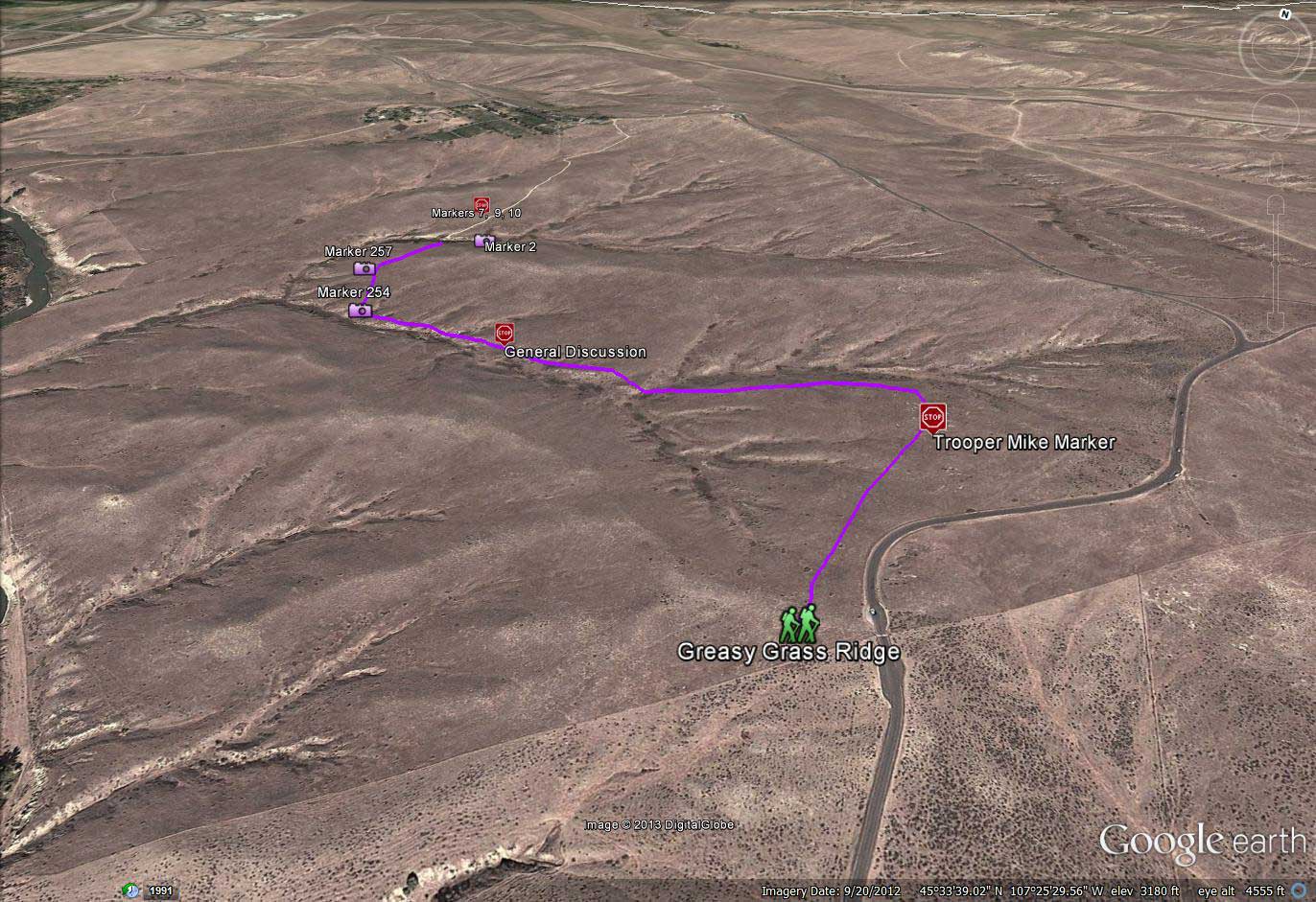
Just after 6:30, following a brief orientation, Doug led the group of fifty-five
eager followers to the backside of Greasy Grass Ridge. We would approach this
evening's walk from the same general direction that warriors entered this
battle. From this concealed position, we enjoyed views of the Little Bighorn
never experienced before. From the Battlefield Road, Greasy Grass Ridge easily
hides the rugged bluffs plummeting to the river. For the everyday visitor, these
views might as well be on the dark side of the moon. We were the lucky ones to
see it.
Doug then motioned us to move up to and over the
Greasy Grass Ridge crest where the immense views of Battle Ridge opened before
us. We could see it all from Last Stand Hill to Calhoun Hill. We could almost
imagine the warriors positioned here doing battle with troopers of Company C
over there on Calhoun Hill.
Doug led us northwest, moving along the side of Greasy Grass Ridge. We soon
stopped and Doug talked about the variety of the weapons used in the battle.
Greasy Grass Ridge is an appropriate backdrop for the subject since quite a
large number of Indians used this ridge as cover while firing at the soldiers on
Calhoun Hill. Not all Indian warriors possessed firearms, so once they did, that
weapon was made use of until it no longer functioned. Doug noted the Indians had
45 types of guns at the beginning of the battle, including nonmetallic cartridge
pistols, muzzle-loading rifles, and shotguns, as well as contemporary repeating
rifles of several makes. As the action progressed, the Indians employed the .45
- caliber Model 1873 Springfield carbine and .45 – caliber Model 1873 Colt
revolver as these became available from wounded, dead or routed soldiers.
From the writings of Doug and others, most know by now that during the
archaeological investigations in the years after the brush fire of 1983 the
battlefield was treated much like a modern crime scene. Forensic microscopy
techniques were used to precisely compare firing pin marks in cartridge cases,
one to another, which enabled like cartridges to be assigned to a specific
firearm of known type and caliber. The same determination could be ascertained
by examination of bullet slug rifling marks. Doug explained how specially suited
epoxy resins are used to make casts of the artifacts with such fidelity to the
original that the microscopic surface features are perfectly captured. A similar
technique is used to replicate bones and bone fragments as we would soon see.
When the locations of gun-related artifacts exhibiting like markings were
overlaid on a map of the terrain, movement of that particular firearm became an
element of fact.
As we angled north, away from Greasy Grass Ridge and into the Calhoun Coulee
drainage, we were entering a large area of the battlefield where very few of the
general public have set foot. Our presence there was only by way of approval of Superintendent Denice Swanke, who joined us on the trip. Friends
member Jim Thorn captured the feeling of a totally new way of experiencing a
place very familiar to us all, “The field trip was incredible, and gave such a
new perspective, since we were able to see things from the Indian perspective of
the terrain. You could really see how the terrain worked very well for the
Indians…”
There was no path to follow as Doug led the way over the rolling green carpet
that a 2001 survey of
park vegetation described as, “relatively pristine among southeastern Montana
grasslands. [1]” We proceeded easily at a moderate gait through lush, ankle-high
grasses, ivory stalks of yucca, and navigated the occasional patch of prickly
pear cactus, their pink buds just opening into handfuls of yellow.
After a walk of about five minutes Doug stopped at a slanting marker, number
128. During the 1985 archaeological survey work at the battlefield a near
complete set of skeletal remains were found here. The survey team named the
remains “Trooper Mike” because they were found in Square M of the survey area
which had been marked off in a grid of alphabetically labeled sections, or squares.
The group circled the marker and became silent as Doug began the
story of Trooper Mike. Excavation of the site first revealed a boot containing
the bones of a right foot and ankle with the lower leg bones protruding.
Nearby was found a six to eight inch deep pit of about a 30 inch diameter,
containing nearly the rest of the skeleton and four buttons. Various fragments
of bone and gear were uncovered near the pit. Doug explained how the remains could have been arranged closely enough together to fit the confines of
the shallow pit only after decomposition of the softer matter, meaning probably
during either the 1877 or 1879 reburial party.
The trooper was determined to be 19 – 22 years old and about five feet seven
inches at the time of his death. The remains indicate he was struck by three
bullets, or two bullets plus a fragment of one of the two; and skull fragments
showed the result of a sharp blow to the head. Other skeletal marks indicated
mutilation. After apologizing in advance for their stark nature, Doug then
passed around photos of the remains as they lay at discovery and the
rearticulated skeletal remains, which were later reinterred. And then, from his
black satchel, Doug pulled an exact replica of a piece of bone, found on this
spot, which had been split by the bullet slug still wedged in the fissure. This,
too, was passed one to another and handled gingerly, as if it were the actual
bone fragment it resembled in every detail.
We angled west down Calhoun Coulee, marveling at the solitude of the place. Here
we were out of sight of the road and structures of the park. The few markers
here go unseen by human eyes for months at a time, perhaps years. Said Jim
Thorn, “The isolation of these markers struck me greatly…Can you imagine being
there amongst all the chaos, dust, noise, with people trying to kill you?” I
shared Jim’s thoughts then and have felt the chill of that feeling at other
spots on the battlefield. It’s almost indescribable. “Those lonely markers just
talked to me, Jim said.
As we neared the junction with Deep Ravine, Doug paused and spoke of
finding the partial remains of a soldier whose fate may have been shared by
others. Near to, and around, this marker - which today is identified as Grave
Marker 2 - were found the
bullets of at least six firearm types, indicating he was the target of at least
six warriors. Yet no military cartridge cases were found nearby, indicating the soldier
had no firearm or failed for some reason to use it. Was he terrified and running
for his life? Had he fallen from his horse and was shot before he could defend
himself?
The story of this incident highlights a difference between the disciplines of
the archaeologist and the historian. Friends board member Ryan Trainor spoke
ably to this point. “Doug described how the science of archaeology does not
place great concern with the same details that historians grapple with. Doug
talked about how they weren’t so concerned with whether this last kill was
mounted or dismounted, nor could they tell what company or from where he had
come exactly when he met his death. While historians endlessly puzzle these
questions, Doug seemed to look at the hard data in front of him: five different
weapons, fired at fairly close range. He presented the evidence as if before a
court of law; anything other than the data was effectively conjecture, and to my
mind that illustrates how archaeologists and historians think differently, as
much as both disciplines overlap and contribute to one another.”
We turned north toward Deep Ravine and crossed it near its head. The young, the
fit and the bold negotiated the friable soil and slick grasses of the steep descent
into the ravine and the equally abrupt ascent of the far slope. I, and a few
others, opted for the more scenic (read safer) route, making our way along a
fairly level contour line that traced an inverted V toward the head of the
ravine, but delivered us at the same point as our panting colleagues. Regardless
of how it was crossed, the trip through Deep Ravine was a rare treat for all.
Jim Thorn commented, “The grins on EVERBODY'S face, once they
crashed/fell/stumbled into Deep Ravine! The smiles on everybody was priceless!”
Treading once again on more easily covered ground my thoughts returned to the
ravine and the maelstrom of emotions, dust, screams, gunfire and smoke, blood,
and last breaths it embraced on a sweltering afternoon one hundred and
thirty-seven years before. The extremes of frantic despair and exhilarating
supremacy that coexisted in that constricted gully is shuddering to even begin
to imagine, and impossible to fully conceptualize.
Once over a low rise, the group made its way onto the Deep Ravine trail and
began the ascent to our point of origin at the Visitor Center. Along the way
Doug would stop briefly to describe the artifacts found at some of the markers.
An 1876 five cent piece and an iron-backed rubber comb were unearthed at marker
7. Around the marker were discovered several bullets which had been fired
nearly straight into the ground.
Closely located markers 9 and 10 typify a phenomenon common in this area.
Excavation of these so-called “paired markers” consistently produced remains of
a sole individual. Doug said this may be the result of the original markers
being erroneously placed at the end of parallel, body-length depressions where
soil was scooped or shoveled from the sides onto the remains in the center. Some
are of the opinion that these “spurious markers” were left intentionally to
represent the twenty-eight bodies, described in eyewitness accounts, which were
never retrieved, nor their remains subsequently found, in Deep Ravine. The
remains of the soldier found between markers 9 and 10 indicated a body lying in
a prone
position. An iron arrowhead and bullets were found in the area of the rib cage,
and a .45 – caliber Colt revolver bullet was in the area of the head. Suicide?
Remember, archaeology is all about the facts. Hypothesis and conjecture lie in
the realm of the historian.
Thanks to
Doug, we had an incredible field trip.
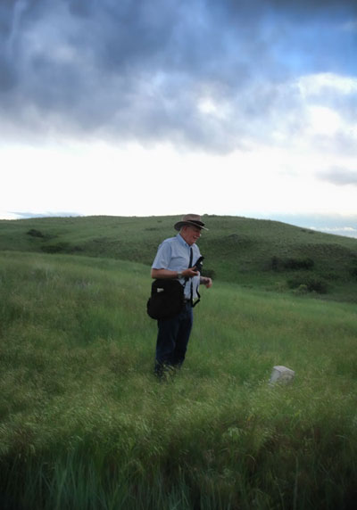
Bob Reece photo
One can read about all the Little Bighorn Battlefield archaeological
investigation briefly touched upon here in the many books authored and coauthored
by Dr. Scott and others; and compelling reading it is, to be sure. But now, just
for a moment, envision
yourself standing in the very grasses of America’s iconic Indian/US Cavalry
conflict, listening to the highlights of years of diligent, scientific
investigative work from a foremost expert on the process and results. And you
can ask that expert, “Just Doug,” a question and he responds to you with an answer. If that
image appeals to you, you need to join the Friends of the Little Bighorn Battlefield
because only members have first chance for tickets to next
year’s field trip. Jump here to join
now.
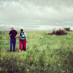
Bob and Joanne share a private moment
as the field trip comes to a close.
Photo courtesy Lola Mauer
An abridged bibliography of works by Dr. Douglas D. Scott
[1] A Systematic Survey of Vegetation at Little Bighorn Battlefield National
Monument;
Sara Simonson, Natural Resource Ecology Laboratory, Colorado State University,
Fort Collins, CO (2001)


. Photo LM")


 and Pat Sulser had barely finished performing in the Hardin Battle Reenactment to make it to the field trip on time. Photo BR")


 and 6(L). Deep Ravine behind them, trees in national cemetery on horizon. Photo SN")
 and Chris Ziegler stand at marker 5. Photo BR")