| Friends Of The Little Bighorn Battlefield |
The Next Generation In The Study Of Custer's Last Stand |
Drawing Battle Lines |
| • The Battle • Archeology • Memorials • Little Bighorn Store • News • Book Reviews |
The Map Testimony of Custer's Last FightBy Michael N. DonahueBook Review by Bob Reece, April 23, 2008All excerpts from Drawing Battle Lines, copyright by Michael Donahue and Upton & Sons, Publishers
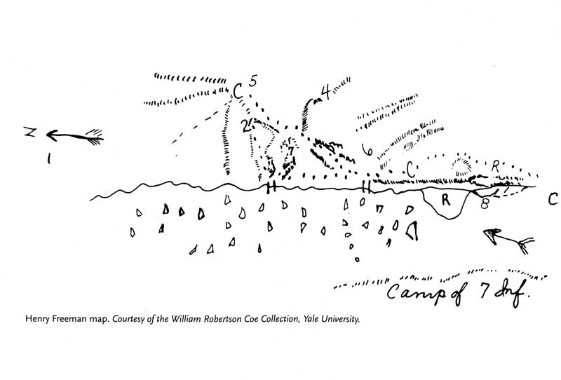
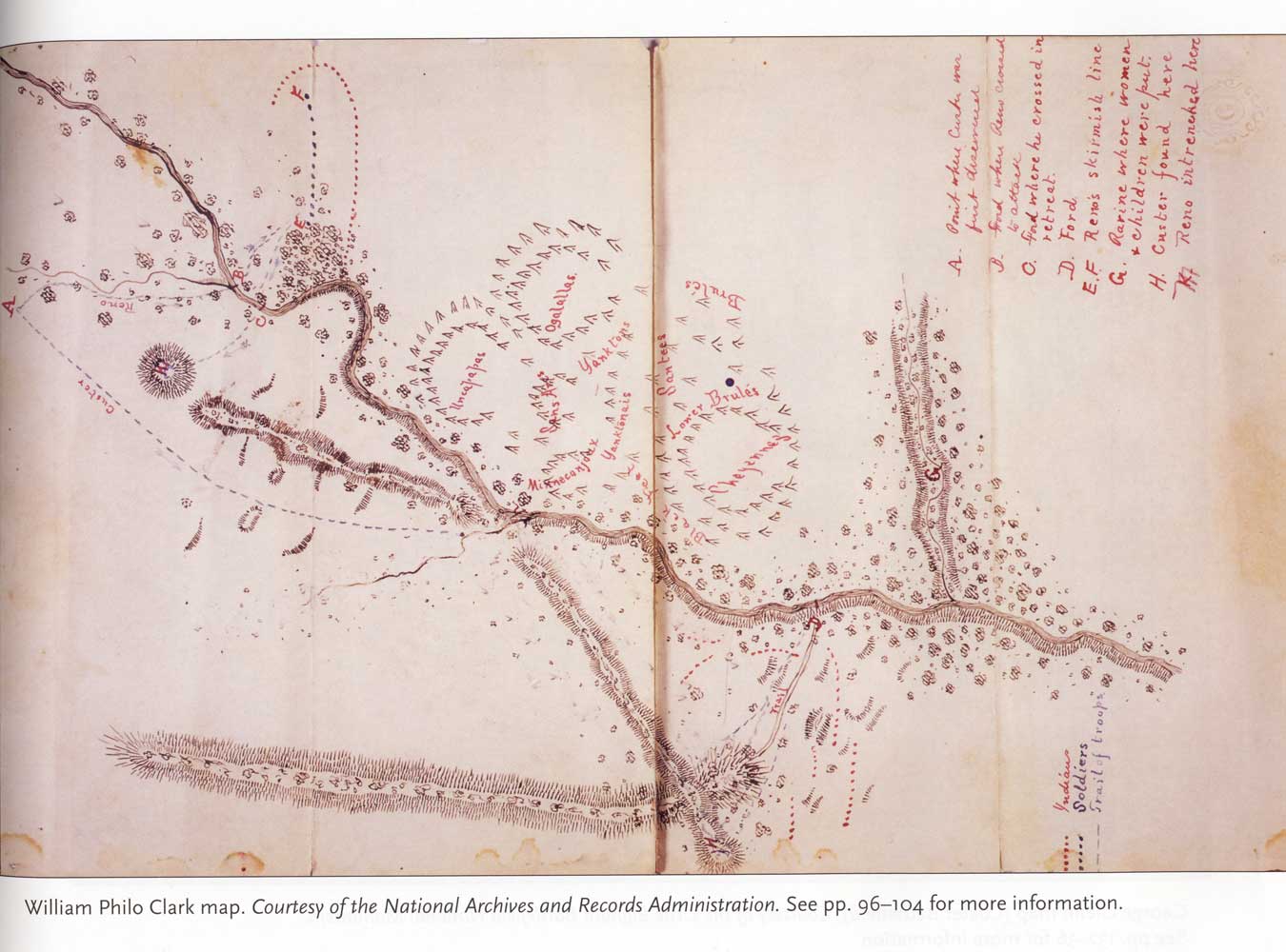
Henry Freeman map All attempts to understand how Custer’s five companies (C, E, F, I, L) ended-up where they fell have perplexed historians. Even from the beginning, on June 27, 1876 when Benteen rode over nearly the entire field of death, he was already reviewing the battle in his mind. Benteen saw evidence of a formidable defense and skirmish line within the carnage on Calhoun Hill, but chaos on Last Stand Hill. Man’s curiosity will not allow questions to remain unanswered. That is what drove Benteen to make sense of the whole battle, and exactly what happened on June 25 and that is an important element in Michael Donahue’s tour de force, Drawing Battle Lines: The Map Testimony of Custer’s Last Fight. At the outset let me make it clear what Drawing Battle Lines is not; there is no detail narrative with a beginning and ending of Custer’s Last Stand, but it is a compilation of primary material made up of maps of the Battle of the Little Bighorn. If one longs for a new book of the Custer fight along the lines of Graham’s Custer Myth, or Camp’s Custer in 76, then one is sure to find satisfaction. In his introduction, Mr. Donahue presents an overview of the Sioux/Cheyenne War of 1876 along with an aerial photo of the battlefield with major landmarks labeled. A modern diagram of the battle is also included. Both charts help the novice understand and follow the different historical maps and the stories they tell. What follows is the result of 30-plus years of gathering and studying these 92 maps. Included in the book are a total of 120 images with 24 color reproductions of battlefield maps. Each map is reproduced in a full-page (sometimes two), landscaped format measuring nearly 11 X 9 inches.
William Philo Clark colored map
The reader is given a huge expanse of first-degree evidence in the form of charts and original accounts made by the map-maker. Where the maps were presented by a warrior, Mr. Donahue notes the interpreter(s) used in the translation. The reader experiences the exciting prospect of reaching their own conclusions of June 25, 1876 from the material; we don’t have to completely depend on the writer to do that for us, although each map is explored fully by Mr. Donahue. He analyzes every drawing to explain how the battle might have evolved. Drawing Battle Lines offers a great deal of battle information; although this format may differ from most Little Bighorn Battle books, its content is far more powerful. The maps are organized in sections, including: soldier, warrior, civilian, and miscellaneous (newspaper and magazine articles). Where the map-maker sketched countless diagrams, like Chief Engineer Officer Edward Maguire, who drew the first official map of the battlefield, Mr. Donahue includes all of them (where possible), and explains each and its transformations.
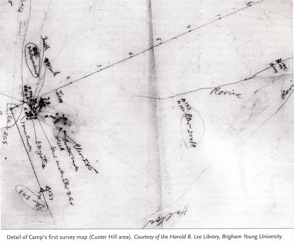
Detail of Walter Camp's first survey map (Custer Hill area)
At the end of each map, the author provides a gray summary box that highlights the important aspects of each drawing. This is a great gift that the reader will appreciate most when he/she must search the book to locate a certain map, but cannot quite remember which chart to look for. As the reader digests these diagrams, one begins to see patterns from this battle emerge, such as: there was indeed a ford at the mouth of Deep Ravine (where there is not one today); the actual location of the Deep Ravine can no longer be in doubt; the missing 28 troopers in the Deep Ravine are located on Camp’s map (page 275) exactly where the mid 1990s NPS ground penetrating radar study found anomalies in the soil; and movements and actions by Custer’s troops beyond the National Cemetery. Finally, readers will learn what the horses' hooves north of the Indian village in Big Beaver's drawing actually represent.
Big Beaver's Map of the Little Bighorn Battle
Drawing Battle Lines is not just a book of maps; rather, it is a mechanism for the reader to step back and analyze the evidence for themselves. It is also a book of celebration for those who lived through this battle. Mr. Donahue not only provides biographical information for these mapmakers, but he brings them to life. An example is Little Bighorn warrior Respects Nothing who drew his chart on the floor of Frank Galligo’s new home. Many important maps are published for the first time such as John Stands-In-Timber's provided courtesy of Dr. Margot Liberty.
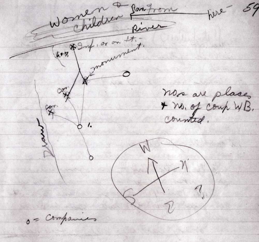
White Bull map
Still writing his battle book, Mr. Donahue believes it's several years away from publication, but it is already a mysterious, albeit highly anticipated, narrative of the Custer Battle. If one reads carefully between the lines of Drawing Battle Lines, one will find many clues to that future book. I had fun reading Drawing Battle Lines. Using my best magnifying glass, I reviewed each map thoroughly to challenge myself and draw my own conclusions before I read the original accounts and Mr. Donahue’s interpretation. I suggest you do the same; it is a whole new way to read about the Battle of the Little Bighorn. Actually, I think reviewing primary evidence for yourself is always the best way. Read our interview with DonahueBooks On The Horizon Home |
|
|||
|
Copyright 1999-2016 Bob Reece Friends Little Bighorn Battlefield, P.O. Box 636, Crow Agency, MT 59022 | Home |
Board of Directors |
Guest Book | Contact | Site Map
| |
||||